A recent article published by Innovation News Network, titled “Transforming wildfire management through geodesy and geospatial science,” underscores a shift in how scientists and emergency agencies are approaching one of the most destructive consequences of climate change. As wildfires grow in scale, frequency, and intensity across multiple continents, researchers are increasingly turning to geodesy and geospatial science to refine both prediction and response strategies.
The report highlights how advances in Earth observation technologies are enabling more precise monitoring of environmental conditions that contribute to wildfire risk. Geodesy, the science of measuring Earth’s shape, gravity field, and rotational dynamics, is being combined with satellite-based geospatial data to create highly detailed models of terrain, vegetation, and atmospheric conditions. These tools allow researchers to detect subtle changes in land deformation, soil moisture, and vegetation stress—factors that can indicate heightened vulnerability to fire.
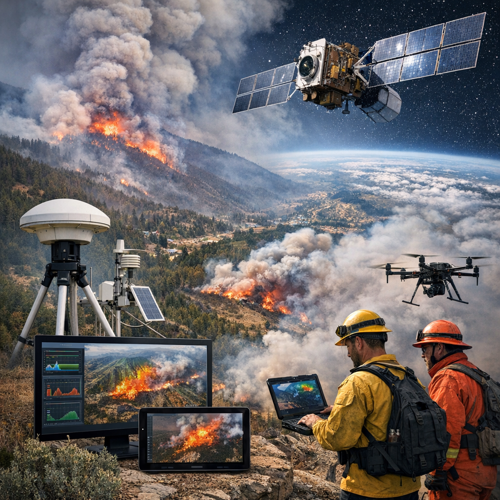
According to the article, one of the most significant developments lies in the integration of satellite imagery with real-time data analytics. High-resolution imagery from space agencies and private providers can now track fire ignition points, map fire spread, and assess damage with unprecedented speed and accuracy. When combined with geographic information systems, this data supports dynamic modelling that helps authorities predict how fires may evolve under different weather scenarios.
The Innovation News Network piece also points to the growing role of Global Navigation Satellite Systems in wildfire management. GNSS data contributes to precise positioning and timing, which is essential for coordinating emergency responses in rapidly changing environments. Firefighters can use GNSS-enabled tools to navigate hazardous terrain, while incident command centers rely on synchronized data streams to allocate resources more effectively.
Another key aspect discussed is the use of remote sensing technologies to monitor fuel conditions. Satellites equipped with thermal and multispectral sensors can identify dry vegetation, changes in land surface temperature, and even chemical signatures associated with plant stress. These insights help authorities target preventive measures such as controlled burns or vegetation management in high-risk areas before fires ignite.
The article also emphasizes the importance of interdisciplinary collaboration. Wildfire management is no longer confined to firefighting agencies alone; it now involves geoscientists, data analysts, climate researchers, and policy experts. By pooling expertise, these groups aim to create comprehensive systems that not only respond to fires but also anticipate them.
Despite these advances, the article notes that challenges remain. Data integration across different platforms and jurisdictions can be complex, and there are ongoing concerns about ensuring equitable access to advanced technologies, particularly in regions with limited resources. Furthermore, while predictive models are improving, uncertainty remains inherent in forecasting natural phenomena influenced by rapidly changing climate conditions.
Nevertheless, the overall direction is clear. As outlined in “Transforming wildfire management through geodesy and geospatial science” by Innovation News Network, the convergence of geodetic measurement and geospatial intelligence represents a significant evolution in wildfire science. By improving situational awareness and enabling proactive strategies, these technologies offer a path toward more resilient landscapes and communities in the face of escalating wildfire risk.